Livestock
Practical technology for sheep & cattle operations — from water and welfare to mapping, data and emissions
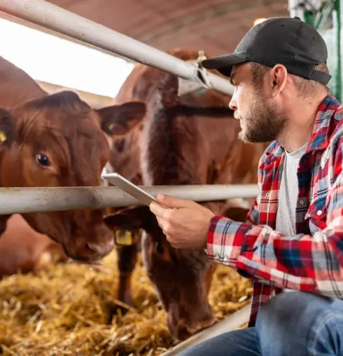
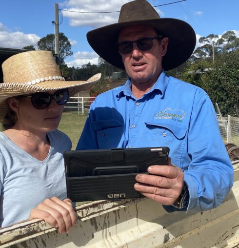
AxisTech helps producers make better, faster decisions using devices, mapping, and data that work together. Our platforms — AxisStream (data management) and FarmMap4D (property mapping) — integrate on-farm sensors, spatial layers and production data to support day-to-day management and long-term business outcomes.
What We Deliver
Water, infrastructure & grazing planning — map paddocks, waters, fences and roads; analyse distances, grazing circles and elevation; estimate safe carrying capacity using cover and land-type history.
Device integration that actually gets used — weather, water, soil and livestock sensors connected into one view via AxisStream.
Livestock productivity, welfare & risk — telemetry, water and pasture monitoring, and full-site device deployments demonstrating ROI in real conditions.
Digitalisation & supply-chain data — data engineering for on-farm to processor flow, traceability pilots, and adoption frameworks with MLA partners and producer case studies.

Proven in the Paddock
Highlight Projects
Coolindown Farms (WA) — Sheep Technology & Mixed-Farm Digitalisation
Coolindown Farms was the first in Australia to use IoT devices to track animal welfare via the Sigfox network, trialling collars on sheep for welfare and lambing insights. The project included telemetry for water, soil moisture and flow metering, delivering management value and practical lessons in deployment. Together with MLA, Coolindown developed an open AgTech device comparison chart to help producers select fit-for-purpose tools that align with FAIR data principles.
MLA Digital Livestock / Digital Farm Projects — Cattle & Mixed Enterprises
AxisTech delivered a whole-of-site device rollout for MLA’s Digital Livestock 4.0 initiative at Romani Pastoral’s Windy Station. This deployment demonstrated how producers can integrate devices across a property to measure water, pasture, and environmental performance. AxisTech’s work extended into operational and supply-chain data projects, linking on- and off-farm data for improved visibility and value-chain efficiency.
Stone Axe (MLA Digital Supply Chain Pilot)
The MLA Stone Axe project, ‘Digitalisation Pilot of Operational & Supply Chain Data Management’ (MLA Project Code P.PSH.1300), saw AxisTech partner with Stone Axe Pastoral to integrate on-farm, feedlot and processor data into a single digital platform. Using AxisStream, data was cleaned, structured, and visualised through dashboards providing performance benchmarking and traceability insights. The project demonstrated how structured, end-to-end data flows deliver value across the supply chain — from genetics and feeding systems to processing and sustainability reporting. Key learnings included the importance of clean data pipelines, consistent device connectivity, and integrating operational data with business metrics to create commercial and sustainability value.
Mapping & Infrastructure at Scale — FarmMap4D
FarmMap4D supports infrastructure mapping, ground-cover time series and carrying-capacity analysis. Used widely by livestock enterprises across Australia, it enables producers to visualise property performance, plan infrastructure and align carrying capacity with climate and pasture conditions.
Tools You Can Use Today
FarmMap4D — Draw paddocks, waters, fences and roads; analyse grazing circles and distance-to-water; evaluate safe carrying capacity using land-type and cover history.
AxisStream — Integrate water, weather, soil and livestock data with QA/QC and role-based access; manage feeds from multiple vendors and support emissions benchmarking and reporting.
Outcomes for Sheep & Cattle Producers
Confidence in water & grazing — detect issues early, plan infrastructure with cost-benefit clarity, and align stocking rates with land condition.
Better welfare & productivity decisions — use telemetry and alerts to intervene sooner, supported by independent comparison tools.
Less double-handling — aggregate multiple data sources into a single dashboard, reducing manual work.
Future-ready data — establish foundations for emissions accounting, traceability and market credentials.
Supply chain visibility — learning from the Stone Axe project shows how integrating device and operational data provides benchmarking, traceability and business intelligence advantages.
How We Work with You
Scope & priorities — focus areas such as water security, grazing capacity, welfare, or connectivity.
Device shortlist — unbiased options matched to operational needs and budgets (informed by MLA comparison work).
Install & integrate — connect devices to AxisStream; map assets in FarmMap4D; set alerts and dashboards.
Adoption support — training and workflows to embed new technology in everyday farm operations.
Want to See It in Action?
Coolindown Farms: practical lessons from sheep technology deployments.
Stone Axe: digital supply chain integration for cattle enterprises.
MLA Digital Livestock: whole-farm integration for productivity and insight.
FarmMap4D: property mapping and grazing capacity tools for planning and management.