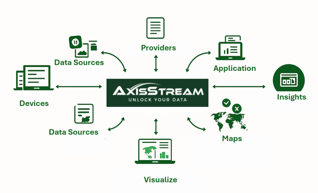
AxisStream is AxisTech’s data management platform. It brings together information from devices, farm systems, and partner software into one structured view so users can see what is happening on farm and across the business clearly and consistently.
Built around the principle of a Single Point of Truth, AxisStream turns fragmented data into connected, trusted information that supports productivity, compliance, and sustainability across the agrifood sector.
Who It’s For
A secure, multi-party platform where growers and businesses retain ownership and control of their data
Built for interoperability and aligned with the FAIR data principles (Findable, Accessible, Interoperable, Reusable)
Designed to connect multiple data engines including device data, structured databases, GIS and imagery to unlock real-world value
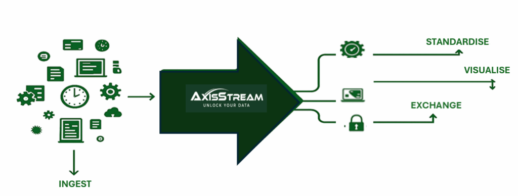
HOW IT WORKS
Ingest – Connect paper records, spreadsheets, devices, files and systems (weather, water, soil, livestock, mapping, PDFs, CSVs, and third-party APIs).
Standardise – Convert data into consistent formats and units for easy reuse.
Visualise – Dashboards and maps show what is happening, where, and why. No multiple logins required.
Share & Exchange – Use permissioned sharing and data exchange functions to securely collaborate with researchers, industry partners, and supply chains.
Key Capabilities
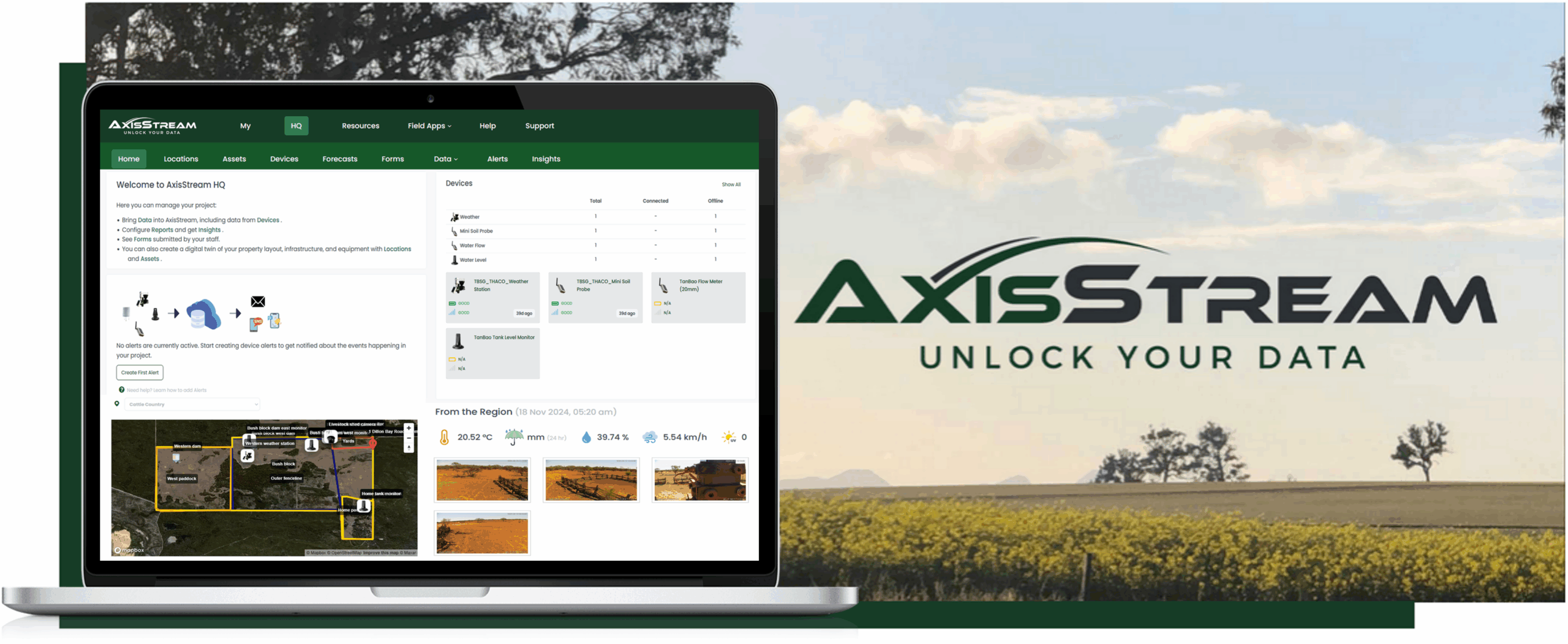
AxisTech Device Dashboarding
View live and historical data from AxisTech’s IoT devices including weather, water, and soil monitoring in a single, unified dashboard.
Device & System Integrations
Connect seamlessly with other operational platforms like AgriWebb, StockAID, John Deere, Xero and more, creating a connected ecosystem for day-to-day operations and reporting.
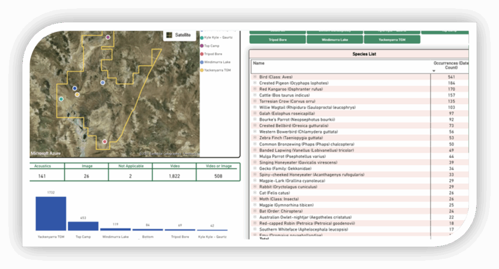
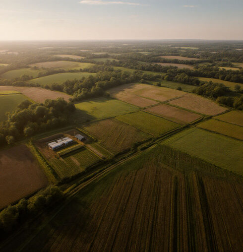
Maps & Locations
Map farm boundaries, paddocks, and infrastructure; overlay soil, weather, and production data; and visualise assets and activity across multiple sites.
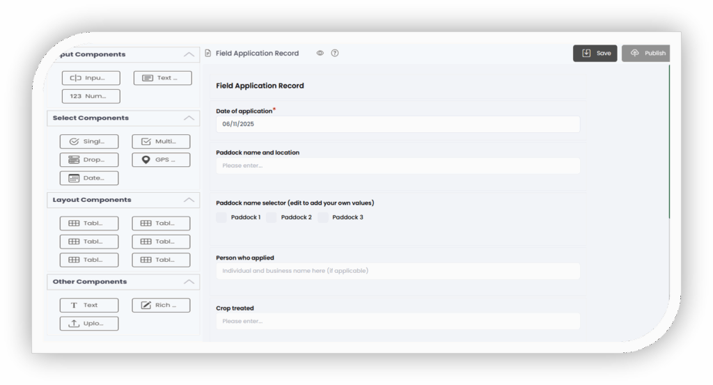
Custom Forms for Data Collection
Digitise daily operations with customised forms for rainfall, tank runs, safety checks, and other on-farm tasks — reducing paperwork and improving accuracy.
Insights & Reporting
Generate clear insights for operations, compliance, and sustainability, using connected data for faster, evidence-based decision making.
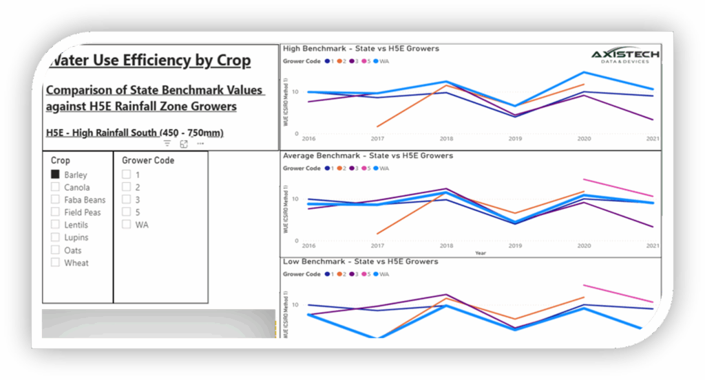
Benchmarking
Compare performance against aggregated or industry benchmarks in a secure, permissioned environment.
Forecasting
Use AI-driven weather and commodity forecasts to anticipate change and plan proactively.
Scenario Views
Model potential changes – from management practices to operational strategies – to understand their impact on emissions, performance, and profitability.
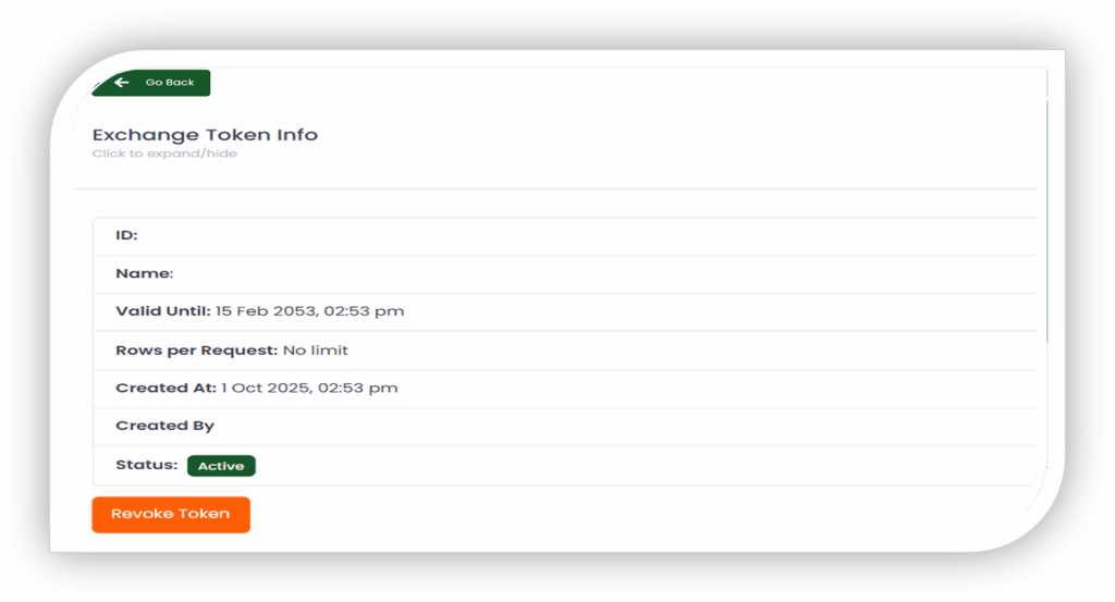
Data Exchange & Permissioning
Enable secure, structured sharing of datasets between growers, researchers, and supply chains, with full control over who accesses what and when.
Machine-Readable Outputs
Export structured data (CSV, JSON, GeoJSON) that other systems can process automatically for research, reporting, and partner collaboration.
Who It’s For
Farmers & agribusinesses wanting one secure place for data, mapping and reporting
Researchers & industry projects needing clean, interoperable datasets for insights
Supply chains & program partners requiring permissioned, traceable data sharing
Why It Matters
AxisStream helps producers and partners balance the fundamentals: productivity, profitability, and sustainability. It removes duplication, enables forecasting and benchmarking and builds trust in data shared across the value chain.
Agricultural emissions – carbon-intensity mapping and improvement for cropping systems
Livestock Data – connecting livestock management and supply chain systems to enable data-driven insights for herd performance, traceability, and emissions benchmarking across grazing enterprises.
Ceres Tag – Grazing Management System enables seamless data integrations with Ceres Tag Data.
Data Hubs – regional networks like the EZI Bushfire Water Network, Stirlings to Coast Weather Network, WA Farm Data Sharing, and Vineyard of the Future Data Hub
Data Exchange – secure benchmarking and emissions data sharing across agrifood supply chains
FAQs
Q: What is AxisStream?
A: AxisStream is AxisTech’s data management platform that brings together information from paper records, excel spreadsheets, devices, farm systems and software into one structured view for clear, consistent decision-making.
Q: What does ‘Single Point of Truth’ mean?
A: It means all key data is stored and standardised in one place, improving accuracy, reporting and the ability to share and reuse information securely.
Q: Do growers retain ownership of their data?
A: Yes. AxisStream is designed so growers and agribusinesses maintain full ownership and control of their data at all times.
Q: How does AxisStream handle data sharing and exchange?
A: AxisStream includes permissioned sharing and data exchange functions, allowing growers, researchers, and supply chains to collaborate securely and control who accesses their data.
Q: What can AxisStream connect to?
A: AxisStream integrates with operational systems such as AgriWebb, StockAID, John Deere, Xero, and AxisTech IoT devices, creating a connected digital ecosystem.
Q: How does forecasting work in AxisStream?
A: AxisStream combines device, operational and environmental data with AI-driven modelling to deliver weather and commodity forecasts. This helps producers plan ahead, anticipate risk and make proactive decisions.