Biodiversity Monitoring & Management
Supporting healthy ecosystems, resilient landscapes and measurable outcomes
At AxisTech, we recognise that biodiversity is central to sustainable agriculture, environmental resilience and future‑proofed land use. From urban tree planting to rangeland condition, our platforms bring devices + data + mapping together to empower decision‑makers with insight, verification and action at scale.
Why Biodiversity Matters
Healthy ecosystems underpin productive farms, sustainable water and nutrient cycles, and climate‑resilient landscapes. Whether you’re managing a city verge, a pastoral lease or a cropping property, tracking biodiversity means being able to monitor vegetation cover, habitat integrity, species indicators and ecological change — and then using that insight to act. AxisTech helps you turn biodiversity ambition into measurable outcomes.

Our Capability — From Urban Trees to Rangelands
Device integration & data pipelines — Our remote water and soil‑moisture sensors, camera systems and connectivity solutions are built for harsh conditions — farmland, remote paddocks or urban plantings.
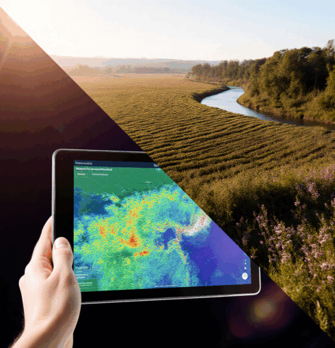
Mapping & change‑tracking — Via our mapping platform (formerly FarmMap4D), we enable time‑series analysis of ground cover, vegetation health and infrastructure impacts.
Platform scale & analytics — Through our data management platform (AxisStream), we ingest, QA/QC, visualise and deliver dashboards tailored to biodiversity actions, stakeholder groups, and reporting needs.
Proven partnerships & applications — From urban revegetation to rangelands innovation, we’ve supported projects that span setting‑up, tracking, verifying and improving biodiversity outcomes.
Proven in the Paddock
Highlight Projects
Urban: Rotary Club of Melville – Tree Planting & Urban Forest Monitoring
The Rotary Club of Melville has partnered with the City of Melville and community groups to plant thousands of native seedlings (e.g., banksia, marri) across Perth’s urban forest. AxisTech supported this work through soil‑moisture monitoring and data‑management services that help track tree survival rates, soil‑moisture trends and post‑planting performance. This capability enables community groups to present robust data on survival outcomes and adaptive management.
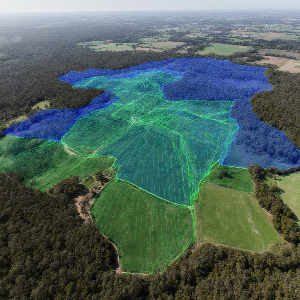
Rangelands: Challa Station – Automated Biodiversity Monitoring & Natural‑Capital Tracking
Challa Station is a 180,000‑hectare pastoral lease in WA’s southern rangelands where innovative natural‑capital and biodiversity monitoring is being piloted. Through its “Challa Project”, the station has partnered with AxisTech and collaborators to deploy automated monitoring solutions that enable real‑time, scalable insights into vegetation condition, habitat health, animal movements and soil‑moisture trends.
What was deployed:
Networked soil‑moisture sensors and remote water‑point monitors to detect shifts in landscape hydrology and stress‑signals.
Camera systems and image‑based sensors with machine‑learning object detection for species or habitat‑use indicators (e.g., feral‑animal ingress, native fauna movement).
Connectivity infrastructure (including satellite/Starlink assist) to support data flows in remote regions.
Time‑series ground‑cover and vegetation‑health mapping via FarmMap4D‑based overlays to benchmark change and recovery.
• Dashboards and alerts via AxisStream to translate raw data into actionable insights (e.g., early warning of pasture decline or vegetation dielectric shifts).
Key outcomes & learnings:
- By automating data capture, Challa Station shifted from episodic field‑surveys to continuous monitoring — significantly increasing the density, frequency and detail of observations.
- Integrating soil, vegetation and habitat‑use data gave the station a digital baseline of natural‑capital — useful for restoration, funding, compliance or investor reporting.
- Sensor and mapping data helped optimise water‑point re‑location, track revegetation survival and identify early‑stage land‑condition decline (e.g., cover drop, moisture trend).
- The project emphasised that scalable biodiversity monitoring requires data pipelines (QA/QC, latencies, connectivity) and user‑friendly dashboards so station staff can interpret results without extra analytics burden.
- The pilot has become part of broader regional programs like the Southern Rangelands Pastoral Alliance (SRPA) and South‑West WA Drought Resilience Adoption & Innovation Hub, illustrating how station‑level tech links to regional ecosystems.
Why this matters for you:
If you manage a large grazing property or pastoral lease, the Challa Station example shows how remote‑monitoring technology can move you from reactive condition‑checks to proactive ecological management:
- Track ground‑cover and habitat integrity as part of your business’s resilience strategy.
- Use real‑time alerts to act on early warning signs rather than waiting for periodic inspections.
- Build a defensible record of vegetation health and natural capital — attractive for markets, investors or future carbon/biodiversity‑finance pathways.
- Deploy proven sensors and platforms (AxisStream + FarmMap4D) already used in remote, challenging conditions.
What This Means for Your Business
Measure success — Use soil‑moisture, vegetation‑cover time‑series and infrastructure mapping to track restoration or revegetation outcomes.
Plan smarter — Map planting zones, water infrastructure, fencing and grazing overlays to optimise habitat regeneration.
Report confidently — Dashboard tools support internal decision‑making and external stakeholder reporting (investors, community, compliance).
Scale sustainably — Our platforms support everything from local urban plantings to large pastoral leases, enabling you to grow from demonstration to enterprise scale.
Ready to Explore?
Reach out for a demo or consultation: how we can tailor biodiversity‑monitoring solutions to your urban project, farm property, regional landscape or natural‑capital program.