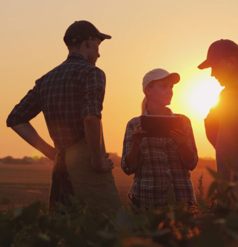
Turning spatial data into smarter grazing, infrastructure & land-management decisions
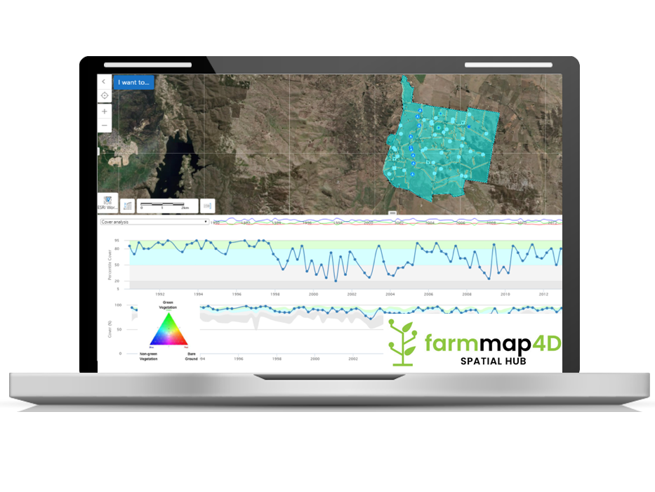
FarmMap4D is a web-based mapping and analytics application built by AxisTech that helps Australia’s rangelands and grazing enterprises manage land condition, infrastructure, and grazing systems more profitably and sustainably.
History & Evolution
FarmMap4D was originally developed within the Cooperative Research Centre for Spatial Information (CRCSI) — a nationally significant research collaboration that advanced Australia’s spatial science and analytics capability between 2003 and 2018. Within the CRC, FarmMap4D was shaped through strong research and industry engagement, particularly with pastoral enterprises, government agencies, and regional NRM groups across northern and inland Australia. This foundation established FarmMap4D as a practical yet research-validated tool for landscape management and infrastructure planning.
In mid-2017 the platform was commercially established as Farm-Map Analytics, later becoming Spatial hub Analytics.
In 2023, AxisTech acquired Spatial Hub Analytics and FarmMap4D, integrating its proven GIS-mapping and spatial-analytics platform into AxisTech’s broader AgTech ecosystem. This acquisition has accelerated FarmMap4D’s evolution—bringing together remote-sensing, digital mapping, and farm-systems data into one interoperable platform. Today, it forms part of AxisTech’s Data Platform suite, enabling users to create a “digital twin” of their property, overlay satellite time-series data, and plan infrastructure, grazing and environmental strategies with greater precision and sustainability.
Why it matters
In extensive grazing landscapes, infrastructure distances are large, ground-cover shifts matter for both productivity and carbon outcomes, and strategic investment in water, fences and paddocks must align with land condition and climate risk. FarmMap4D brings together remote-sensing, geospatial mapping and farm-planning workflows so producers and land managers can:
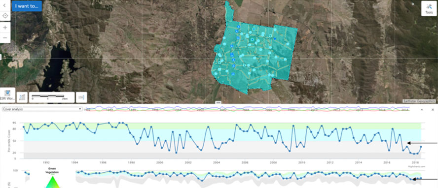
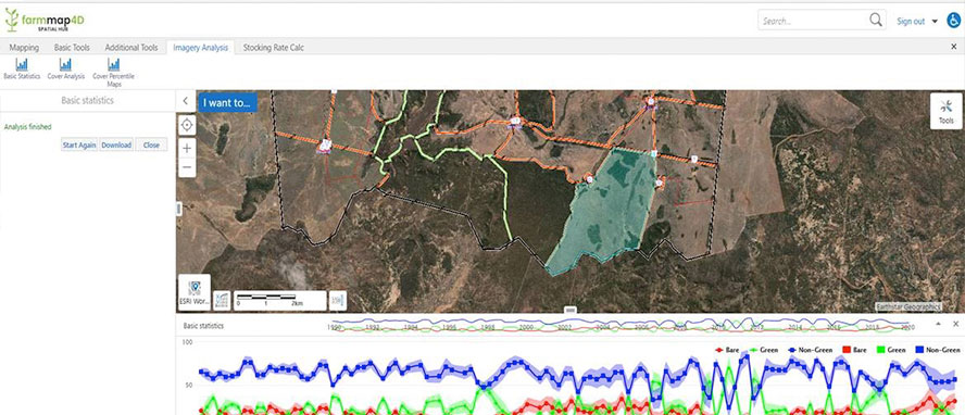
Visualise land-condition trends and ground-cover change across time.
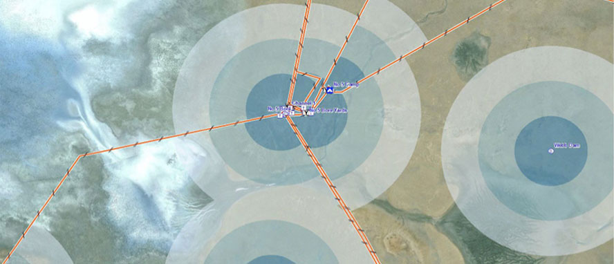
Plan infrastructure (water, fences, roads) with elevation, distance and grazing-circle insights built in.
Explore “safe carrying capacity” under different grazing, cover and infrastructure scenarios—helping match stocking rates to land-condition and reduce degradation risk.
Support climate-positive, resilient and sustainable production systems that adapt to environmental change while maintaining profitability.
Key features
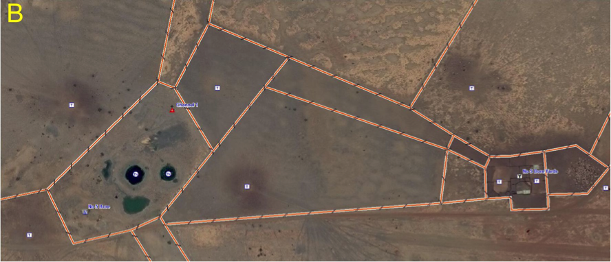
Infrastructure mapping & planning
Draw paddocks, water-points, fences, roads; assess distances and elevation.
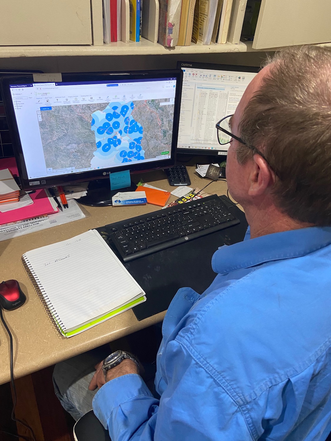
Grazing circle analysis
Generate water-point centred grazing circles to understand watered vs un-watered land, supporting grazing planning.
Safe carrying-capacity estimation
Integrate land-type, infrastructure, condition and grazing scenarios to estimate sustainable stocking rates.
Exportable maps and data
Publish geo-referenced maps and export tables or screen-shots for desktop/mobile use.
Secure online access
Cloud-based mapping with satellite and on-ground data accessible via web interface.
Who it’s built for
Grazing enterprises and pastoral leases aligning infrastructure investment, stocking strategy and land-condition tracking with profitability and sustainability.
Natural-resource-management organisations and regional NRM partnerships operating in remote or rangeland systems.
Advisors, agronomists and consultants working across extensive grazing, seeking scalable mapping tools that combine satellite-cover data with farm-planning workflows.
Why AxisTech
FarmMap4D’s origins in the CRC for Spatial Information ensure a strong research foundation, while AxisTech brings the technology, integration, and delivery capability needed to take that science into practice. As technologists who understand the vitally important role technology plays in research adoption and practice change at scale, AxisTech connects spatial science with producers through data, sensing, automation, and digital platforms. This ensures FarmMap4D remains both technically robust and operationally relevant—empowering producers to plan, measure, and manage for long-term sustainability and resilience.
For larger grazing operations, custom integrations or data-services, contact AxisTech to discuss how FarmMap4D can be tailored to your enterprise or region.